Original: $15.09
-65%$15.09
$5.28The Story
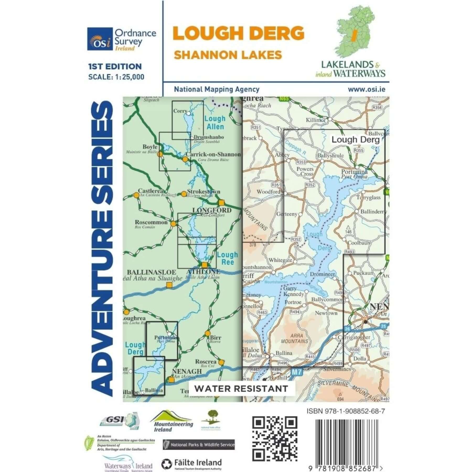
This map covers a section of the Shannon River from Portumna through Lough Derg in the north extending down to Killaloe, County Clare and Ballina, County Tipperary. The counties of Clare and Tipperary comprise the majority of the map, with a smaller area of County Galway included.
The N52 is shown, and runs through Borrisokane. The R352 and a small section of the M7 are included. The major towns are Portumna, Terryglass, Borrisokane, Mountshannon, Dromineer, Scarriff and also Ballina County Tipperary and Killaloe County Clare. Nenagh is included as a special insert, indicated with a red line A-B.
The main feature of this map is the River Shannon which enters Lough Derg near Portumna and flows out between the towns of Killaloe, County Clare and Ballina, County Tipperary.
Bays and harbours are a feature of the lough and include Portumna Bay, Terryglass Harbour, Nutgrove Harbour, Dromineer Bay, Mountshannon Bay and Scarriff Bay.
Numerous islands are dotted along the length of the lake and include the following islands; Illaunmore, Iniscaltra, Spa Island North and South, Goat Island and Rabbit Island. The River Nenagh flows into Lough Derg near Dromineer.
Boat hire is a major activity on the River Shannon. Water sports and activities are the emphasis of this map, with additional information provided for activities on the river. Navigation Channels and Navigation Markers along with Slipways, Mooring Points, and Locks are just some of the additional features on this map series.
Numerous walks, ways and trails are dotted throughout the map. Among them are the Forest Friendly Trail, East Clare Way, Nenagh Cycle Hub Loop 01/02/03, Lough Derg Way, Ballycuggaran Loop, Crag Wood Walk, Arra Mountain Loop, and Graves of the Leinster Men Loop.
Three Discovery maps 1:50 000 also cover this area with Sheet 53 covering the northern part of the map and Sheet 59 covering the southern part. Sheet 58 covers the south western portion.
Details & Craftsmanship
Every detail has been carefully considered to bring you the perfect product.
Description
This map covers a section of the Shannon River from Portumna through Lough Derg in the north extending down to Killaloe, County Clare and Ballina, County Tipperary. The counties of Clare and Tipperary comprise the majority of the map, with a smaller area of County Galway included.
The N52 is shown, and runs through Borrisokane. The R352 and a small section of the M7 are included. The major towns are Portumna, Terryglass, Borrisokane, Mountshannon, Dromineer, Scarriff and also Ballina County Tipperary and Killaloe County Clare. Nenagh is included as a special insert, indicated with a red line A-B.
The main feature of this map is the River Shannon which enters Lough Derg near Portumna and flows out between the towns of Killaloe, County Clare and Ballina, County Tipperary.
Bays and harbours are a feature of the lough and include Portumna Bay, Terryglass Harbour, Nutgrove Harbour, Dromineer Bay, Mountshannon Bay and Scarriff Bay.
Numerous islands are dotted along the length of the lake and include the following islands; Illaunmore, Iniscaltra, Spa Island North and South, Goat Island and Rabbit Island. The River Nenagh flows into Lough Derg near Dromineer.
Boat hire is a major activity on the River Shannon. Water sports and activities are the emphasis of this map, with additional information provided for activities on the river. Navigation Channels and Navigation Markers along with Slipways, Mooring Points, and Locks are just some of the additional features on this map series.
Numerous walks, ways and trails are dotted throughout the map. Among them are the Forest Friendly Trail, East Clare Way, Nenagh Cycle Hub Loop 01/02/03, Lough Derg Way, Ballycuggaran Loop, Crag Wood Walk, Arra Mountain Loop, and Graves of the Leinster Men Loop.
Three Discovery maps 1:50 000 also cover this area with Sheet 53 covering the northern part of the map and Sheet 59 covering the southern part. Sheet 58 covers the south western portion.